
There’s a reason Striding Edge turns up on more Lake District bucket lists than any other stretch of rock in Cumbria, and it isn’t subtle. It’s one of the sharpest, most exposed ridge walking England has to offer, and it leads straight to the roof of the Eastern Fells. Even Wainwright, who rarely reached for a superlative he didn’t mean, called it a place “for the connoisseur of mountain scenery” — and he wasn’t a man given to sending people somewhere they shouldn’t go. I’ve walked Helvellyn a dozen ways over the years, but this loop — up over Birkhouse Moor, along Striding Edge, over the summit, down Swirral Edge and back by Catstycam — is the one I keep coming back to. The Adventurer’s Route, and it earns the name.

I say that as someone who’s spent a fair chunk of the last twenty years on ground like this, Mountain Leader ticket in hand, walking groups over exposed ridges for a living as much as for love of them. Striding Edge and Swirral Edge aren’t technical climbing by any stretch — no ropes, no gear beyond boots and a steady head — but they’re the real thing all the same. Rock on both sides of you, a drop that means something if you get it wrong, and no shortcuts once you’re committed. That’s precisely why people come.
The Adventurer’s Route
Route Map and GPX
A full loop of Helvellyn from Glenridding taking in both of its famous aretes: up over Birkhouse Moor and along Striding Edge to the summit, then down Swirral Edge and over Catstycam before dropping back through the old Greenside valley. Three Wainwrights, two proper scrambles, and a pint at the end of it.
HOW TO USE THE MAP
For the best ‘experience’ using the map, click on that box in the top left to go ‘full screen’ (Esc to come back). Click icons to reveal details. Zoom by pinching or hold CTRL and roll the mouse.
Route at a glance
- Distance: 12.9km (8 miles)
- Ascent: 925m (3036ft)
- Time: 5-6 hours
- Start: Glenridding Bridge, NY 38693 16925
- Difficulty: Difficult
- Map: OS Explorer OL5
- AW Book: The Eastern Fells
Wainwrights
- Birkhouse Moor: 718m (2356ft)
- Helvellyn: 950m (3117ft)
- Catstycam: 890m (2920ft)
Field notes
- Terrain: Grass and stony path up Birkhouse Moor, then hands-on scrambling along Striding Edge and the Bad Step, a broad stony summit, and a similarly exposed scramble down Swirral Edge before the pull up Catstycam
- Navigation: Straightforward in clear conditions — the ridge line is obvious and well-trodden — but serious in mist, wind or ice. Carry a map and compass regardless
- Parking: Pay-and-display in Glenridding village. Arrive early — this route fills the car parks fast on a good day
Watch out for
Exposed scrambling on Striding Edge and the Bad Step down-climb — serious in wind, rain or ice.
Why do it
Three Wainwrights, the finest ridge walking in Lakeland, and a pint at the Traveller’s Rest to finish.
Dog friendly?
No. The scrambling and exposure on both edges make this one for two feet, not four paws.
Is this walk for you?
This is a serious mountain day, not a stroll with a scramble bolted on. If you’re steady on rock, comfortable with exposure on both sides of you at once, and confident turning back or dropping to Red Tarn if the weather turns, it’s one of the best days out the Lakes has to offer. If you’ve never scrambled before, or you’re not sure how you’ll handle a drop either side of a narrow path, go with someone who has done it, on a calm, dry day, and treat the escape route down to Red Tarn as a real option, not a last resort.
The best route to Helvellyn that I can offer you
I’d checked the forecast three times the night before and once more over breakfast, which is standard practice for me on a day like this rather than nerves — Striding Edge in good conditions is a proper adventure, and Striding Edge in high wind or ice is a different proposition entirely, one I’d sooner read about than repeat. The forecast held: warm, clear, barely a breath of wind. Good enough.
Birkhouse Moor from Glenridding
From Glenridding Bridge the path climbs steadily through bracken and scattered oak, Ullswater dropping away below and the Helvellyn range building ahead of you a ridge at a time. On a clear morning you can watch the lake steamers cutting their wake down towards Pooley Bridge while you’re still low enough to hear them. It’s a proper pull up onto Birkhouse Moor — not technical, just relentless — and by the time the ground levels out at the summit cairn you’ve already banked 557 metres and your first Wainwright of the day.

Birkhouse Moor doesn’t get much attention — most people treat it as a warm-up on the way to somewhere bigger — but the summit cairn earns its keep. Ullswater stretches out behind you to the north-east, and dead ahead, Striding Edge shows itself properly for the first time: a thin dark line running out to Helvellyn’s summit plateau. Once you’ve seen it from here, there’s no unseeing it.
The view of Catstycam, your finally, is stunning as it catches the early morning sun.
The Infamous Striding Edge
The path drops slightly to a gap in an old boundary wall — the Hole-in-the-wall, and as good a marker as any for where the walking stops being a walk. Whoever built that wall was working sheep ground, not thinking about ridge scramblers a couple of centuries later, but it’s become the line everyone uses without meaning to: stop here, check your laces, take a breath, because beyond it the ridge narrows fast and there’s no casual way back once you’re committed to it.

Striding Edge is an arête, a knife-blade of rock carved out by ice fifteen thousand years ago and left standing when the glaciers that shaped it were long gone. You can scramble along the crest itself if your head’s steady, hands on rock the whole way, or drop onto the sheep-trod path just below it on the Red Tarn side, which most people do sooner or later whether they planned to or not. Either way, there’s no getting across this ridge by accident. You have to want it.
There comes a point anyway when you just have to drag yourself onto the ridge. You can’t NOT DO Striding Edge. I recommend you start at the beginning on the top, get used to the exposure from the get go, and by the time you get to the harder bits you’ll know if you need to pull out.
Red Tarn

Red Tarn sits directly below, the ridge on its southern flank, a genuinely beautiful pool of water hemmed in by Catstycam on one side and the wall of Helvellyn on the other. It’s also your escape hatch — if the ridge gets too much, there’s a path down off Striding Edge to the tarn and back out via Red Tarn Beck, no shame in it. I’ve pointed more than one nervous walker down that path myself.
It’s worth remembering what you’re actually walking across up here. Everything below you — the tarn, the corrie it sits in, the ridge itself — was carved by a glacier that filled this whole bowl during the last ice age and didn’t finally let go until around fifteen thousand years ago. Striding Edge is what was left standing either side of it once the ice pulled back: an arête in the proper geological sense, ground down to a blade by forces that make an afternoon’s scramble feel very small indeed.
The Bad Step (The Chimney)
Two-thirds of the way along, the ridge throws its one real obstacle at you: a short, steep down-climb where the crest drops away and you have to lower yourself off a rock step using hands and feet both. Locals call it the Bad Step or The Chimney. It looks worse than it is, but only once you’ve actually done it — from above, in wind, with a drop either side, it has a way of concentrating the mind.

There’s no way round the Bad Step, only through it. Face into the rock, take your time, and don’t let the walkers queuing behind you rush you — I’ve seen more people come unstuck hurrying this than anything else on the ridge. Test each hold before you trust your weight to it, keep three points of contact where you can, and remember that going slowly here costs you two minutes, where going fast and getting it wrong costs you a great deal more. Once you’re down, the worst of it’s behind you.
There is actually a route to the left side (from the top of the Chimney) but it is very exposed and the ledge so small it’s very scary looking. Maybe next time.
Helvellyn Summit
From the bottom of the Bad Step it’s a short, steep pull up loose scree to Helvellyn’s broad summit plateau, and after the exposure of the ridge, the width of the top feels almost absurd — you could land a plane on it, and in fact, someone once did.

Grough Memorial
A short walk from the trig point is the Gough Memorial, raised for Charles Gough, who fell to his death near here in 1805. His dog stayed with the body for three months before anyone found them — the story that’s said to have inspired both Wordsworth and Scott to write about it. It’s a quiet, sobering stop on a summit that doesn’t always feel like it needs reminding how serious it can be, but it’s worth the reminder anyway. In two decades of taking people onto ground like this, I’ve learned that the walkers who read that plaque properly, rather than glance at it on the way past, tend to be the ones who make good decisions lower down when the weather turns. That’s not superstition. It’s just respect, and this hill has earned every bit of it.

Stone Shelter
They don’t call the shelter on the summit of Helvellyn a shelter for nothing. The exposure on the top of this mountain can be cruel at times. This one, shaped in a cross, can have 20 hikers huddled on one side and nothing but the wind and sleet pounding the other. It’s an awesome piece of kit.

Ordnance Survey Trig Pillar
The trig pillar marks the highest point of the Eastern Fells at 950 metres, and on a clear day the view runs from the Solway Firth to the Pennines, Scafell Pike and the Isle of Man showing themselves if the air’s clean enough. It’s also, more often than not, thick with cloud and wind — I’ve stood here in full sun and I’ve stood here unable to see my own boots, sometimes within the same hour. Helvellyn makes its own weather more readily than most Lakeland summits, and it doesn’t ask your permission first.
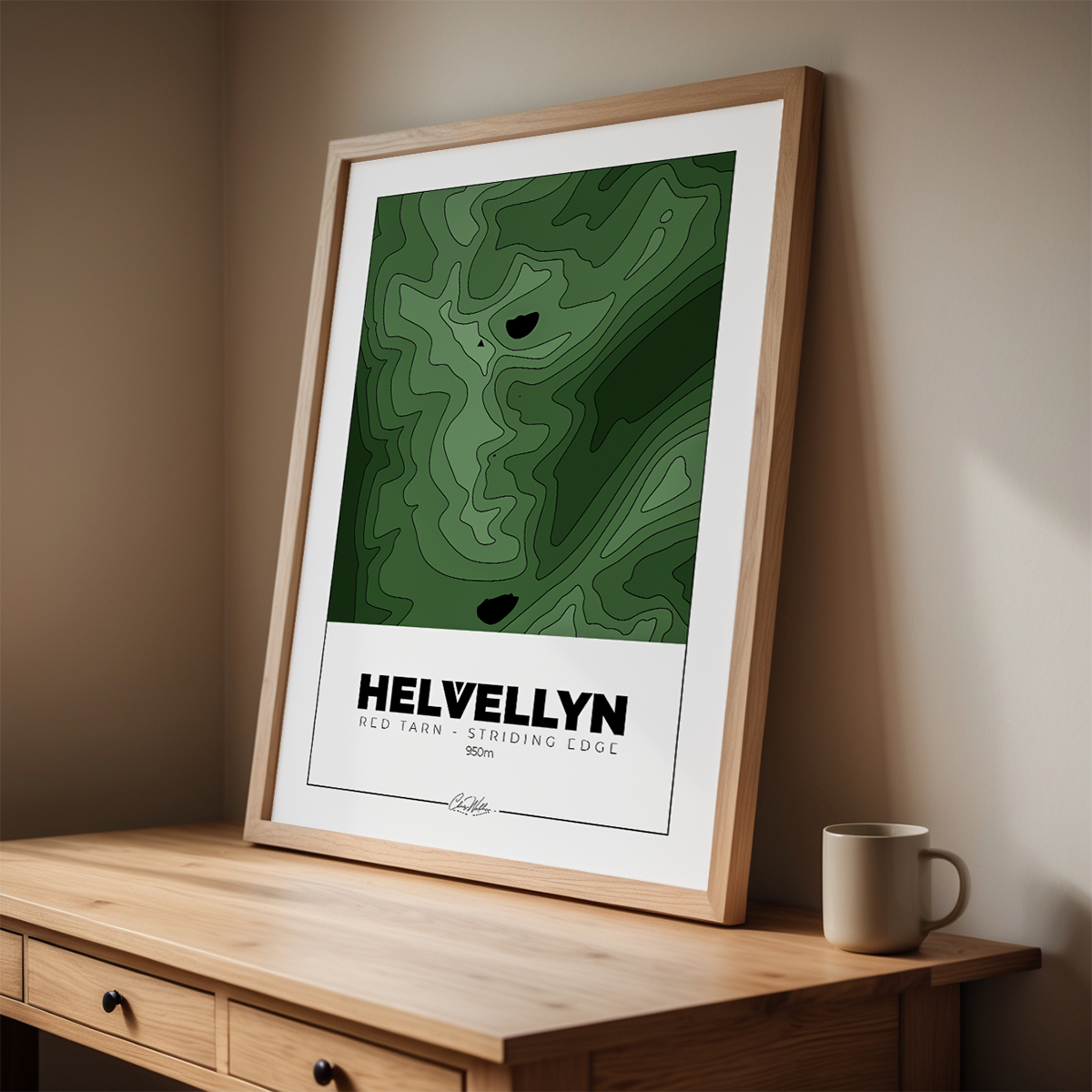
The shape of this ground
Nothing puts Striding Edge, Red Tarn and Catstycam into context quite like seeing the whole massif from above. My green contour map of Helvellyn shows every ridge, tarn and re-entrant of this ground and framed ready to hang — the kind of thing that turns a good day on the hill into something you can look at properly, every day, long after the boots are dry.
Helvellyn’s summit is a crossroads more than an end point, and from the top of Swirral Edge, on the plateau’s north-eastern corner, the descent starts almost as suddenly as Striding Edge began. It’s shorter and, most days, a shade less nerve-wracking than its southern twin, but don’t let that fool you into treating it casually — it’s still a proper scramble down loose rock with real exposure either side.
Descending Swirral Edge

More accidents happen on the way down a ridge than the way up, in my experience, simply because the legs are tired and the concentration that got you across the first edge has a habit of slipping just when you need it least. Treat Swirral Edge with the same respect you gave Striding Edge, not less.
Swirral Edge drops you down between Helvellyn and Catstycam, with Red Tarn sat below you the whole way and Catstycam’s near-perfect pyramid rising dead ahead. It’s steep enough that most people go down facing the rock in the top section, and it’s every bit as committing as Striding Edge for the time it lasts — just shorter.
Catstycam
At the bottom, rather than turning straight back towards Glenridding, the Adventurer’s Route earns its name one more time with a gentle pull up Catstycam — then a steep descent down the easter flank (first time I was there in cloud I didn’t even notice you could get down, just looked like a drop into the abyss).

Catstycam’s summit is tight, pointed, and gives you the best view of the day looking back at Helvellyn and the two ridges you’ve just crossed — you can trace the whole route with your eye, Striding Edge, the summit plateau, Swirral Edge, all of it laid out at once. It’s a proper little mountain in its own right, symmetrical enough from certain angles that it’s easy to see why some maps still mark it under its older name, Catchedicam. It’s the view that makes sense of everything you’ve just done.
Here’s a group I took on the Hel and Back event, celebrating an amazing achievement (one never scrambled before, one scared of heights).
Wild camp at Red Tarn

Below Catstycam, the ground eases off towards Red Tarn again, past the point on the ridge above where the escape path drops down from Striding Edge — a reminder, on the way past, of how many people that route has quietly saved a bad afternoon for. There’s a flat spot on the Catstycam side of the tarn that is a delight to camp on.
The Return to Glenridding – Follow the flow
The way back follows Red Tarn Beck down to Glenridding Beck, over a footbridge and past Greenside Mine. Lead was worked out of this valley for the best part of two hundred years, right up until 1962, and the scars of it are still there if you know to look — spoil heaps gone green with grass, the odd stretch of leat, buildings that once housed a working community and now stand silent but for the wind. There’s something about walking through an old industrial landscape on your way down off a mountain that puts the day into a longer perspective: people have been making a hard living out of this ground for centuries, in weather worse than anything I’ve ever camped in. Glenridding’s rooftops appear below you a good while before your legs believe it.
Time for a pint at the Travellers Rest
The Traveller’s Rest sits at the ‘top of the hill’ in Glenridding, and there is no pint in the Lake District that tastes as good as the one you’ve earned crossing two ridges and bagging three Wainwrights for.

Boots off, or at least loosened, and a table outside if the weather allows it. I don’t always remember every step of a big day like this one clearly, but I remember the first pint of Helvellyn Gold at the Traveller’s Rest every single time — that particular mix of tired legs, aching shoulders and a sense that you’ve just done something that mattered, even if the only person keeping score was you.
Glenridding does double duty in this corner of the Lakes — it’s the start of the Adventurer’s Route up onto Helvellyn, and it’s also where I limped back in after two days on the Ullswater Way, a wild camp on Gowbarrow Fell and a very large breakfast at Granny Dowbekins in between. Different kind of tired to a big ridge day, feet rather than forearms, but just as earned — I remember sitting on a bench by that same bridge on a pitch black night, completely done in.
READ NEXT

The Ullswater Way
Glenridding’s other big walk — a full lakeside circuit of Ullswater, no scrambling required, just some of the best walking in the Lakes, 22 miles and 3 Wainwrights.
YOU MAY BE INTERESTED IN

Mountain Confidence
If a ridge like Striding Edge has you second-guessing yourself before you’ve even started, this is where to begin — building the skills and the head for exposed ground properly, not by accident on the day.